Autoridades de EE.UU. responden a derrame de petróleo en el Golfo de México
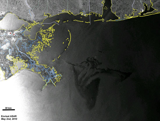
In this radar image, acquired from Envisat’s Advanced Synthetic Aperture Radar (ASAR) on 2 May 2010 03:45 UTC (Saturday night local time), the oil spill is visible due east of the Delta National Wildlife Refuge extending into the Gulf of Mexico. The white dots are oil rigs and ships. Radar is especially suited for detecting oil spills. ESA

In this radar image, acquired from Envisat’s Advanced Synthetic Aperture Radar (ASAR) on 2 May 2010 03:45 UTC (Saturday night local time), the oil spill is visible due east of the Delta National Wildlife Refuge extending into the Gulf of Mexico. The white dots are oil rigs and ships. Radar is especially suited for detecting oil spills. ESA
Regresar al texto de la noticia.
